
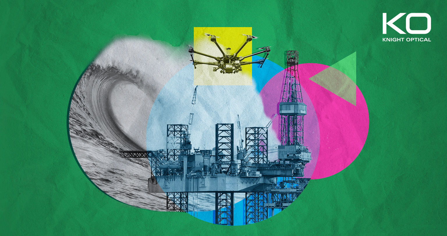
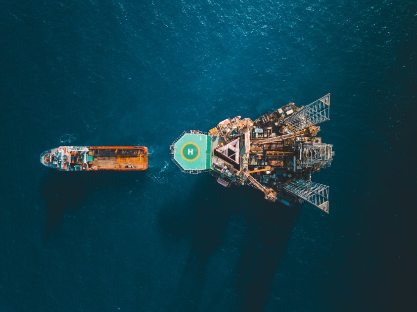
If you’ve recently found yourself both captivated and horrified by the bellowing chant of ‘Yo, Ho, All Hands, Hoist The Colours High’ sea shanty on TikTok, a platform not customarily correlated with the subsea industry, chances are you’ve been immersed in #northseatok. The unexpected fad sparked a newfound interest in the domain, opening the public’s eyes to the genuine threats of operating in the waters. Here, we delve into the truth of working in this area and examine the technological developments driving safety and efficiency at sea.

For those in the profession who are well acquainted with the daily perils encountered at sea, the recordings didn’t come as a shock. But, for viewers unaccustomed to the harsh actualities of ocean culture, the clips of monstrous crashing waves, fierce winds, pitch-black night-time conditions and the eerie abyss beneath the surface were startling. Since the TikToks began trending, there’s been a heightened curiosity and growing attention around life at sea, whether aboard vessels or oil rigs.
Traditionally recognised for its bustling fishing business, thriving shipping routes, and lucrative oil and gas production, the North Sea is also a hub for renewables like the Dogger Bank Wind Farm, which is currently underway and poised to evolve into the world’s largest offshore wind farm. For additional information on projects such as these and to discover our connection to renewable energy, dive into another of our latest blogs on floating offshore endeavours here.
What Optical Technologies and Components Are Used in The North Sea?
With the North Sea hosting an assortment of operations, tech plays an important function in augmenting procedures and ensuring the wellbeing of workforces engaged in the activities mentioned above, as well as scientific research and environmental conservation.
These innovations encompass a mix of methods and tools, including:
Imaging Systems
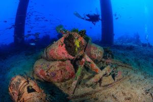
Fundamental in the subsea discipline, imaging is used to assist with all aspects of undertakings in the North Sea – from inspection and servicing of below-the-surface foundations on oil platforms and pipelines to surveying and mapping the seabed to gather imperative data on topography and marine geological elements.
Given the choppy seas, strong currents and limited visibility we’ve all witnessed on #northseatok, imaging systems – regularly deployed using remotely operated vehicles (ROVs) – are essential for operatives to stay protected and reach deeper depths than human divers.
Nevertheless, utilisation isn’t entirely ominous, and it’s not just oil rig personnel and oceanographers who benefit. From an alternative viewpoint, aquaculturists are enjoying the benefits and cutting-edge insights that top-notch imaging delivers, too.
At the end of last year, 3D imaging technology was developed by the University of Aberdeen that can help identify sea lice larvae, which pose several challenges for fish farmers. Leveraging artificial intelligence (AI) and machine learning, underwater holographic cameras were conceived to aid in spotting sea lice from other zooplankton, a task that’s likened to “looking for a needle in a haystack [1]“.
What Optics Can Be Used In These Imaging Systems?
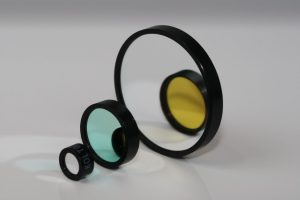
Just some of our optical components normally chosen in these functions comprise:
-

Lenses: Frequently accompanied with anti-reflective (AR) coatings, again, to decrease glare and improve image clarity
- Windows and Domes: Commonly in Acrylic substrates
- Filters: For example, Colour Glass Filters to optimise colour and contrast when capturing underwater footage and Polarising options to reduce glare and refine visibility in at-sea challenging habitats.
LiDAR
We’re no strangers to LiDAR. In fact, we’ve been collaborating with pioneers on optical solutions for these systems – spanning from wind monitoring to construction tools – for many years. Otherwise acknowledged as Light Detection and Ranging, the method utilises light pulses to evaluate subsea infrastructure, creating detailed 3D scans, which are invaluable and become paramount when the waters turn treacherous, supporting in search and rescue missions. For such cases, LiDAR is ordinarily merged with ROVs, allowing for the swift and safe scanning of large undersea areas to locate missing individuals, objects, or divers in distress.
It’s also innovatively brought into play in the planning and maintenance of offshore wind farms. For instance, a recent deployment in the North Sea involves integrating LiDAR with buoys for meteorological investigation. Positioned for a 12-month period, the floatation devices will precisely record wind patterns, including speed and direction, aiding in the efficient and profitable design of future farms [2].
What Optics Can Be Used In These LiDAR Systems?
While LiDAR makes use of multiple optical components, those particularly favoured for subsea implementation include:
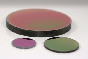
 Optical Filters: Based on a system’s project-specific necessities, filters can cover Bandpass Filters to isolate required wavelengths to Longpass and Shortpass Filters to transmit/block shorter/longer wavelengths
 - Beamsplitters: Serving a few purposes, Beamsplitters can be utilised to direct light to different optical paths, enabling concurrent measurements of subjects.
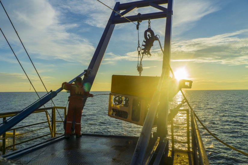
Drones and ROVs
As demonstrated so far, ROVs are indispensable members of subsea teams, equipped with everything from LiDAR for locating people thrown overboard to cameras for snapping high-quality shots of deep, hard-to-access underwater surroundings. With copious cameras, sensors, and often manipulator arms, these uncrewed vehicles excel in inspecting, maintaining, exploring, and recovering articles under the water.
Meanwhile, drones handle duties from above, utilising their aerial perspective to conduct surveys and observe environments. Lately, they’ve been brought on in innovative ways in the North Sea as part of a two-month trial. In September, electric drones showcased the true potential of cargo UAVs by transporting spare parts, equipment, and care packages to three installations in the Gullfaks oil field. The initiative eliminated the typical logistical challenges related to delivering to remote locations, thereby enhancing safety and efficiency [3].
What Optics Can Be Used In These Drones and ROVs?
With the already mentioned abundance of sensors, cameras, LiDAR, and other tech integrated with drones and ROVs, a diverse array of optical components is specified in setups, encompassing:
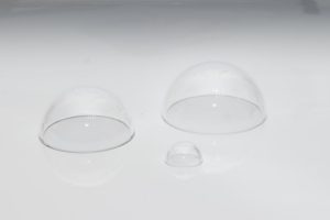 Optical Windows: From economic Acrylic Domes and scratch-resistant Borosilicate Glass to sought-after Sapphire materials
- Optical Filters: With such a variety available on the market, each with their own distinct beneficial characteristics, you can find everything from Bandpass Filters, to enhance the contrast and clarity of images and videos captured by cameras on board ROVs and drones, to Neutral-Density (ND) Filters, which reduce the brightness of ambient light or artificial illumination to capture properly exposed footage. Additionally, Fluorescence Filters are used to detect and analyse fluorescent markers, like corals, algae or certain types of fish, or biological compounds.
Optical Gas Imaging (OGI)
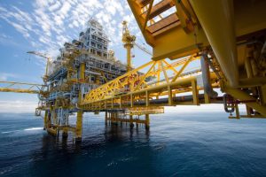 As the home to a staggering 184 oil rigs [4], the North Sea presents numerous combustible dangers. The apprehension, as seen on #northseatok, is further illustrated by films such as Mark Wahlberg’s Deepwater Horizon, which vividly depicts the perilous realities of remote oil sector work. Contrary to the glamour of movie sets, these rigs harbour very real and high hazards.
To mitigate dangers, a range of processes are employed to assess and monitor the safety of structures accurately. Among these is Optical Gas Imaging (OGI), an advanced technology used for identifying fugitive gas emissions, including methane, hydrocarbons, and volatile organic compounds (VOCs), in industrial, high-risk settings. However, it’s not simply about safeguarding; it concerns sustainability, too.
A crucial element of Leak Detection and Repair (LDAR) programmes, OGI is “getting smarter” and “helping the subsea sector to boost LDAR strategies [5]“, with lighter-weight cameras and devices that increase exposure coverage drastically compared to traditional sniffing.
What Optics Can Be Used In Optical Gas Imaging (OGI)?
Infrared (IR) cameras play a leading role in OGI. As such, there are a few IR-specific optics and appropriate substrates used in their application, such as:
IR Windows:
- Germanium (Ge): An in-demand choice for Mid-Wave Infrared (MWIR) and Long-Wave Infrared (LWIR) bands, Germanium Windows are typically associated with their excellent optical clarity and durability
- Zinc Selenide (ZnSe): A more cost-effective option compared to Germanium, Zinc Selenide is particularly popular for MWIR applications.
Laser-Based Positioning Systems
Also known as laser trackers or laser positioning systems, laser-based positioning systems are used for high-precision measurement and alignment. Also prevalent in industries like aerospace and manufacturing sectors, it involves emitting a beam from a stationary source and detecting the reflected beam from a target to determine its position and orientation in three-dimensional space.
What Optics Can Be Used In Laser-based Positioning Systems?
Various optical components are integral to the functionality of laser-based positioning systems, like:
 Lenses: In materials like Sapphire and Fused Silica for high optical clarity coupled with longevity and Wide-Angle variations to capture a broader field of view
- Beamsplitters: Often used for simultaneous measurement or alignment purposes.
FOOTNOTES
[1] https://www.fishfarmermagazine.com/2023/10/09/3d-imaging-could-provide-early-warning-of-sea-lice/
[2] https://www.4coffshore.com/news/wind-lidar-buoys-to-be-deployed-in-german-north-sea-nid28072.html
[3] https://www.energylivenews.com/2023/09/15/electric-drones-soar-above-north-sea-oil-rigs/
[5] https://www.oedigital.com/news/505866-fugitive-methane-emissions-ldar-campaigns-are-getting-smarter